Sunday, September 18, 2011

Starcrossed and Kirkland Triathlon

I had been doing a bit of swimming throughout the summer with the hope of not drowning for my annual appearance in the Northwest Triathlon scene, and was again targeting the Kirkland Triathlon since Roanne and I did it last year and it was pretty fun. Roanne was traveling for work and so was unable to join me this year, but nonetheless I was looking forward to it. As it did last year, it once again conflicted with the Starcrossed Cyclocross race. I didn't really want to choose between the two events, so like last year I decided to do both.

I woke up early on Saturday morning to cool, windy weather and gray skies, and headed over to Kirkland to get my gear set up in the staging area. I ran into my friends Mike and Yuko Schmitt at the starting line, so it was nice to have someone to hang out with as Mike and I are both in the same age division. Here is a shot of Mike and I getting ready to enter the water, we had a delay before the swim started because the bouys that marked the swim course kept getting blown out of position. Check out our coordinated outfits!


We were the second group to start after the elites, and like last year I managed to move off the front of our group during the swim thanks to residual ability left over from swimming in my youthful days. I think there was one guy in our group ahead of me, but it was hard to tell because pretty soon we were catching a lot of people from the "elite" group. Here I am exiting the water:


I had a quicker transition to my bike than last year because I had learned a few things from that experience (lesson #1: putting socks on when your feet are wet is time consuming; don't bother), and pretty soon I was off and rolling. I caught a good number of people on the bike leg, probably because the course was quite hilly and also quite technical. Triathletes aren't known for their bike handling skills so they lose time in corners, and most of them also don't grasp the concept that an aero position only yields benefits when you are going fast, so they end up grinding up climbs in their aero position instead of changing to an upright position that would be more efficient for climbing. Here I am coming into the transition zone after the bike:


After swapping to my running gear I set out on foot, and it soon became obvious that running is not my strength as the people I had passed on the bike leg began streaming by me. I think for next year I will try to do some track workouts, as it would be nice to run a bit faster. Here I am coming into the finish line:


I guess my slow run was good enough, as I managed to win my age group though I didn't stick around for the awards presentation since I was off to my next event, StarCrossed which was being held in Lake Sammamish State Park. This was a change from recent years, it is normally held in the evening at Marymoor Park and while Lake Sammamish is a great venue, I really missed the party atmosphere from Marymoor with the beer garden in the middle of the velodrome. I spent a few hours volunteering (my bike clubs helps run the race), then suited up for the Cat. 3 race. I am normally a Cat. 2, but since the 1s and 2s race together and there are a lot of pros in that field (including Bart Wellens, a Belgian former World Champion) I decided to race down a category.

Unlike recent years I had a decent starting position in about 20th of 80 or so, and after dropping back a few positions in the chaotic start I started slowly working my way up and finsihed the race in 8th. Not bad, and super fun! After my race I spent some more time volunteering in the beer garden and watched the pro races which were really fun. Here is Ryan Trebon, one of the top domestic pros using his long legs to cruise through the beach section:


Bart Wellens ended up winning which was really fun to see. All told it was a good day of racing and I'll be back next year!

Sunday, September 11, 2011

Mount Olympus

For the latter part of our September vacation week, Roanne and I had set our sights on an ascent of Mount Olympus, the highest mountain in the Olympic Range on the Olympic Peninsula. It isn’t visible from Seattle because it is in the interior of the range, but for some reason I felt it was necessary to climb it. It is a pretty involved trip, being 45 miles round trip in length with almost 8000 feet of elevation, so that may have contributed to the appeal.

In any case, after having spent a good part of Wednesday planning, organizing, and packing, at 5:30am on Thursday morning we found ourselves on the Washington State Ferry headed across the Puget Sound to Bainbridge Island. From Bainbridge Island we continued our drive along the north end of the Olympic Peninsula before nearing the coast and trending south, passing through Forks where Roanne swooned at the thought of seeing Edward the sexy Vampire. After reviving Roanne we continued our drive, and by 10:00am we were rolling up to the Hoh Rainforest Visitor Center in Olympic National Park.
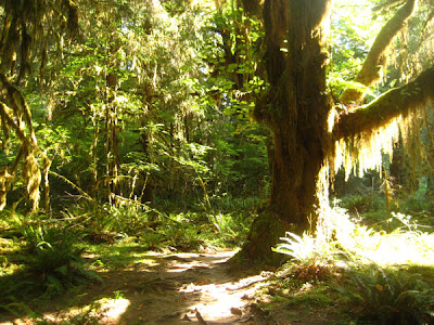
We procured the necessary permits and then shouldered our heavy packs (63 lbs for me, 40 lbs for Roanne, I think next time we’ll pack a little lighter!) and struck out on the Hoh River trail. The goal for the day was to cover the 17.5 miles to Glacier Meadows (our intended camp site) before dark, so we tried to keep a good pace. The trail was really scenic, with nice sections running parallel to the river and plenty of massive trees. As you might expect from a rainforest our surroundings very green:


And very wet (though thankfully none of the water was falling from the sunny blue sky):


Here is Roanne posed in front of a few giant cedar trees:


We stopped every 1-2 hours for breaks to rest our feet and munch on the delicious snacks that we had brought, thankfully there were plenty of good rest stops with campsites every few miles along the trail. Here is Roanne taking a breather at the Olympus Guard Station which was located about halfway to our destination:


As we departed the guard station the trail began to slowly angle upward, and eventually we crossed the Hoh River on a really high bridge and started heading up another valley toward our destination:


After the bridge the trail steepened further and we really started feeling our heavy packs, but we took heart in the knowledge that we were nearing our destination. After passing Elk Lake the trail began traversing along a steep hillside, and at a break in the trees we finally caught our first glimpse of the Mount Olympus massif in the fading sunlight:


With the sun quickly dropping in the sky we tried to quicken our pace, and soon after our first view of the mountain we arrived at a spot where there was a huge trail washout. There was a temporary rope ladder rigged up which we were able to use to descend in the washout and then scramble back up the debris gully to regain the trail on the other side of the washout. Here is Roanne descending the rope ladder:


 Soon after the washout we arrived at Glacier Meadows Camp, though the name is a bit of a misnomer as it would be more appropriately called “Almost Glacier Meadows Camp”, as the camping areas are still in the forest just below the actual meadows. The campsites were mostly empty so we set up shop in a nice spot next to a creek and quickly set up our tent as it was 8:00pm and starting to get dark. At this point we realized that one of our headlamps had dead batteries, stinker! We made some delicious pasta for dinner and then settled into bed just after 10:00pm.

We had ruled out an alpine start for the next day even before discovering that we only had one headlamp, so the alarm went off at 5:30am the next morning and I got up to make breakfast while sleeping beauty grabbed a few more winks. We enjoyed a delicious breakfast and then set about packing up our stuff, though not particularly quickly. Here is Roanne enjoying her morning tea as we are starting to think about booting up:


By 7:00am we were finally ready to roll, and we headed out of camp and up toward the Blue Glacier. Our packs felt light and airy compared to the day before, so we made rapid progress. Here is Roanne ascending up out of Glacier Meadows and onto the talus of the lateral moraine:


Upon topping out up onto the lateral moraine we had a striking view of the board expanse of the Blue Glacier below, with icefalls rising up to snow dome and finally the summit of Mount Olympus:


Awesome! We continued traversing along the lateral moraine to avoid descending down to glacier until we had to:


Upon dropping to the glacier we paused to don our harnesses, crampons, and rope up, and we continued on our way, weaving through the exposed crevasses as the snow cover had completely melted at this elevation and we were walking on blue glacier ice. We paused for snack at the base of Caltech Ridge after crossing the flatter part of the glacier, and basked in the morning sunshine that was now peeking over the mountains:


From this point we started to ascend more steeply up onto Snow Dome, following some faint tracks from climbers who must have been on the route a couple of days prior. The route finding was pretty straightforward, and in short order we were popping up onto Snow Dome. Here is Roanne paused for a snack break with some dramatic scenery in the background:


From Snow Dome we continued across the upper Blue Glacier towards the now-visible summit, before deviating to the left to take the Crystal Pass route that wrapped around the back of the Five Fingers. We had to avoid a few crevasses, some with "hold your breath and don't look down" steps across the abysses, but for the most part it was straightforward walking on snow. We finally reached a rocky section where we made a short traverse and then found ourselves in a saddle between the false summit and the west summit (which is the true summit, being slightly higher than the east summit). We were not 100% sure of the route, it looked like some people had ascended steep snow to gain the rocky summit pyramid high on the north east side, but we decided to try our luck on the 4th class rock as there seemed to an option that traversed towards the south face and then headed up from there. Here is Roanne starting the traverse toward the South Face:


The climbing started out pretty straightforward albeit with a lot of very loose rock that made us question whether or not this was the standard route to the top. About halfway up it got a bit steeper than what we were comfortably scrambling up (partly because it was so loose, so we decided to rope up and pitch it out until the angle lessened though we only had slings to use for protection. I headed up, and soon after departing the belay I accidentally knocked a few rocks off. I managed to yell a warning and Roanne was able to duck in toward the cliff, but two of the larger rocks struck her with glancing impacts. Luckily the bounces had taken more of the impact before hitting her and she just had some bruises to show for it, but this spooked us even further and convinced us that we should have taken the snow option.

Feeling a bit shaken we continued on, and fortunately found a couple of good belays and managed to reach the summit without further drama. We breathed a sigh of relief as we emerged onto the summit, and set about basking in the sun and enjoying the view. We could see the Strait of Juan de Fuca to the north, and plenty of mountains in all directions. Here is the successful summit team relaxing on top:


We then turned around and headed down the way we came, making two rappels and down climbing the rest. We were pretty happy to reach the base of the summit pyramid and step off of the rock back onto the snow. Apparently the Olympic range is known for loose rock and the west summit of Mount Olympus is one of the more solid peaks, I wouldn't want to try any of the loose ones! After eating some well-earned sandwiches we started trooping back down the glacier, here is Roanne soon after starting our downward journey:


 And here I am after passing through Crystal Pass, starting the descent down to Snow Dome:


On Snow Dome we paused to look back at the summit formation. The west summit is the formation just peaking out from behind the foreground in the exact middle of the frame:


We then continued on our way, making good time on the steep parts where we could glissade a bit in the steep snow. After descending from Snow Dome we continued across the lower Blue Glacier, here is Roanne as we near the lateral moraine:


At the lateral moraine we thankfully removed our harnesses and scrambled up the steep and sandy path to the top, and then continued along the rim with a few pauses to try and trundle giant rocks:


From the lateral moraine we dropped back down into Glacier Meadows and enjoyed the stroll through the flowers, though we were pretty sore and tired by this point.


We made it back to camp by just after 5:00pm, and happily swapped our boots for flip flops and began lounging. After an hour or so lying in the tent watching a bee attack mosquitoes we rallied and cooked up some dinner, which we enjoyed with a delicious glass of wine and some chocolate (we hadn't lugged 100lbs of gear up 4000 feet for nothing!) before hitting the sack for an early night.

The next morning we slept until 8:00am, and then after a leisurely breakfast we packed up camp and were ready to roll out by around 9:00am. Here is Roanne getting ready for the 18 mile trek out along the Hoh River:


The walk out was long but uneventful, enjoying the scenery at the beginning and less-so toward the end as fatigue and sore feet started taking their toll. We finally reached the trailhead around 6:00pm, and happily hopped into the Jetta and started the drive back to Seattle, stopping for a nice Oceanside dinner along the way. Here is a GoogleEarth view of our route up the Hoh River Valley and on to the top of Mount Olympus:
 

Tuesday, September 6, 2011

Mount Thompson and Kendall Peak

Back in August I had made an attempt to climb Mount Thompson [link] with a few of my coworkers, and while we were unsuccessful, we did gain a good lay of the land by trying out a number of short cuts which resulted in a lot of bushwhacking. I didn’t want to let all that good knowledge go to waste, so I wanted to go back and make another attempt at getting the shortcuts right and hopefully reach the summit of Mount Thompson in the process. Roanne and I had taken vacation for the first week in September, and after our plans to go further afield disintegrated due to her having to be in Seattle midweek, I decided that a sunny Tuesday morning would be a perfect time to head to the mountains.

I parked at the PCT trailhead near Alpental and started hiking around 7:30am, taking the immediate left onto the first shortcut. This one worked out well, as I successfully rejoined the PCT at the intended point (we had missed that last time and thus ended up at Red Mountain). The second short cut was to exit the PCT at the first big switchback, and I was a little leery of this one since it looked like it would involve substantial bushwhacking. This suspicion was confirmed, but after much fighting my way through brush I was finally back in the basin were we had ended up on our last attempt (mental note: next time don’t wear shorts), looking up at the sun starting to hit the alpine meadows above me.


From here I was able to scramble up the same talus field that we had ascended last time to re-gain the PCT trail. From looking at the GPS track this certainly shaved a lot of distance off, though at times it was pretty slow going through the dense brush so I’m not sure that I would do it again. Soon after rejoining the PCT I was crossing the Kendall Catwalk which was completely free of snow, in contrast to our last outing:


I made good time along the trail without any snow, and before long I was passing Ridge Lake where we had turned around on our last attempt. I stopped briefly to chat with a PCT through-hiker who was basking in the sun by the lake, then continued on toward Bumblebee Pass where I needed to leave the trail and drop into the basin below Mount Thompson. This section of the trail was really nice, being on a hillside that descended steeply to the sparkling waters of Alaska Lake:


I continued on to what I thought was the pass, though I was a little surprised that there wasn’t much of a trail established. I had a good view of Mount Thompson from the ridge crest:


 I was even more surprised when I looked over the other side of what I thought was the pass and saw that it was a several hundred foot cliff. At this point I knew that I was off route, and after sussing out a few short cut options for regaining the correct route I finally gave in to the inevitable and retraced my steps back along the PCT to the real Bumblebee Pass. I headed up and over the pass and then dropped into the basin below Mount Thompson.  The basin was really nice with some snow remaining on the northern aspects, and a mix of heather and meadows filling in the gaps between the talus fields.


 After a short pause to eat a delicious sandwich I headed up a gully towards the East Ridge, which is the 4th class route that I planned to ascend. The gully was a little loose, but a short while later I was on the shoulder where the East Ridge began. I continued up without much difficulty, mostly just steep hiking with a few scrambly sections mixed in. After one final short steep section I was finally standing on the summit at 11:30am, not bad considering my route finding difficulties on Bumblebee Pass. Here I am on top clad in my bright white PNW-issue undergarments:


And here is the full panoramic view from the summit, with not a cloud in sight and Mount Rainier visible on the right end of the picture:


After lazing on the summit for a while I decided to head back down, and with one short rappel down one loose looking section where I couldn’t quite find the easier way I had come up, I resumed scrambling back down the East Ridge and soon found myself back in the basin. I headed up and over Bumblebee Pass and back onto the PCT, and started making my way back toward the Kendall Catwalk. After crossing the Kendall Catwalk I came to the point where we had went part way to Kendall Peak the last time, I decided to head up again and finish the job this time. I passed the intermediate summit that we had stopped on and continued along the North Ridge to the true summit which wasn’t all that much higher than the one we had stopped on. Here is the view from the summit of Kendall Peak looking back toward Mount Thompson, with Mount Thompson visible as the prominent bell-shaped summit in the middle of the frame.


From here I headed straight down the east slopes of Kendall to regain the PCT without any backtracking, and then continued back toward the car. I was remotely tempted to take the bushwhacking shortcut that I had taken on the way up, but my scraped and battered shins screamed in protest so I stayed on the trail until the first of the two short cuts which I had taken that morning which I did take again and at just before 4pm I found myself back at the car. Great success! Here is a topo of my route, the loop in the middle is due to me taking the shortcut on the way there and the trail on the way back, and the fork at the end is due to my routefinding difficulties  near Bumblebee Pass.

Saturday, September 3, 2011

Northeast Buttress of Chair Peak

Back in 2003 when I first moved to Seattle, Roanne and I made an attempt to climb Chair Peak. I only have a hazy memory of that outing, but it was poor weather and I remember being in a lot of fog and ending up on some other formation from which we looked across at Chair Peak during a break in the fog. Ever since that time I have been meaning to go back and climb it, as it is one of the sentinels of Snoqualmie Pass where we spend a lot of time skiing and climbing. My chance finally came at the start of September; on the first day of the Labour Day weekend we headed out to Snoqualmie Pass.

After parking at Alpental we headed up the Snow Lake trail which lived up to its reputation of being the busiest trail in a Washington wilderness area. As we hiked along the trail we had good views of Chair Peak basking in the sunshine:


We ascended on the trail to the Snow Lake divide, and then left the main trail to head along the divide towards Chair Peak. We started on a trail until it descended toward Source Lake, and then we struck out across talus fields and ascended toward the east face of Chair Peak. Here is Roanne heading up, starting to encounter some snow patches:


We were undecided on whether to climb the East Face which is apparently a 5.4, or the Northeast Buttress which is 4th class. We briefly scoped out the East Face, but since I am not a big fan of 5th class climbing on crappy rock with no immediately apparent gear placements, we continued on to the Northest Buttress and started our scramble. Here is Roanne on the shoulder of the buttress about to start heading up, with Snow Lake in the background:


The scrambling was pretty easy going until we got side tracked into heading straight up where we should have traversed left; at this point we deployed the rope briefly before reversing our tracks and getting back onto the standard scrambling route. It was fun climbing on mostly solid rock with a few nice and exposed sections. Before long we were popping over the top of the buttress and making our way onto the nicely shaped summit. Here is Roanne making the final moves to the top:


 And here I am celebrating finally reaching the summit of Chair Peak 8 years after my first attempt:


Most of the accounts that I had read recommended that climbers descend the Northeast Buttress that we had just climbed, and this was reinforced by the numerous rappel stations that we had passed on the way up. I am not a big fan of descending what I have just climbed, so we decided to try and descend one of the couloirs on the south side as I had read that this was the standard descent for winter climbs of the route. After a short scramble down some loose rock we reached the couloir and a few short rappels later we were back in scrambling terrain, heading past some big snow chunks that were slowly thawing in the shady couloir:


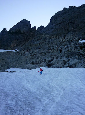
We headed down from here back to the talus field which we descended to a snow field where we had some fun glissading and dreaming of the coming ski season:


 We then headed back down Alpental Valley and made a beeline for the NBBG (North Bend Bar and Grill) where we enjoyed some delicious sweet potato fries, pints, and burgers before making our way back to Seattle.